
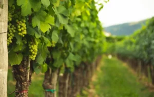
VineForecast researches the use of mobile sensors
Can microclimate data measured by mobile, i.e. moving, sensors serve as training data to improve weather forecasts? To answer this question, VineForecast recently received research funding from the High-Tech Incubator (HTI) of Lower Saxony.
Mobile sensors are designed to be attached to cultivation equipment and vehicles, including tractors, which navigate through diverse fields during regular farming operations. This approach is in contrast to stationary weather stations that remain fixed in a single location. As the vehicles move through various fields, the sensors collect a range of climate data from different locations and topographies. Over time, this rich dataset serves as a valuable resource for training artificial intelligence (AI) algorithms. These AI algorithms make use of the connections between climatic measurements and local topographic features to improve the standard weather forecast and adjust it to the microclimate of a specific location.
In the article on downscaling of weather forecasts, we described how VineForecast already uses AI to generate a high-resolution microclimate forecast from a standard weather forecast. For this purpose, we used measurements from a large number of stationary weather stations from all over Europe to train an algorithm that adjusts the standard weather forecast more precisely to the topographical conditions of a field (slope, orientation, etc.). Somewhat simplified, one can say that the more data this algorithm receives from a wide variety of locations, the better the microclimate forecast.
First experiments with reduced weather station data
In first experiments, we found out that already a fraction of the measurements of a stationary weather station is sufficient when used as training data to lead to a significant improvement of the temperature and humidity forecast. Figure 1 shows in black the error of the standard weather forecast for a weather station on a steep slope on the Moselle, which was on average about 1.8°C in a period from 2011 to 2021. In green the error in the forecast is shown when the algorithm receives training data from the weather station. If the algorithm uses only about 1% of the station's measurement data, the forecast error nevertheless drops to about 1.1°C.
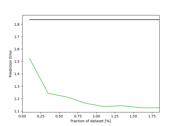
Interestingly, however, the improvement curve flattens with increasing training data, i.e. more and more data from the same location does not automatically lead to an improved forecast in this case. The reason for this is simple. The weather is not only determined by the microclimate. The algorithm has the ability to deal with errors in the weather forecast that are caused by a specific microclimate (slope, orientation, etc.). However, errors whose cause is more "macroscopic", i.e. the error source lies further away, cannot be corrected by this.
First tests and field trials with partner wineries
We are currently in the development stage of the mobile sensor project, with field trials set to begin in late-April. Our project aims to improve microclimate forecasts by creating a network of mobile climate sensors and refining the appropriate downscaling algorithms. In our preliminary tests and upcoming field trials we are working with MeteoTracker, a company that provides weather stations designed to take measurements on the move.
During the upcoming field trials, we will also collaborate with a group of four clients. We are happy that the wineries Harth & Harth, Brand, Strickhof Trotte Wülflingen , and Habitat eG are part of this research project!
Before the trials begin, we focus on validating the mobile sensors to ensure their accuracy and using them to analyze local climate variations related to topography.
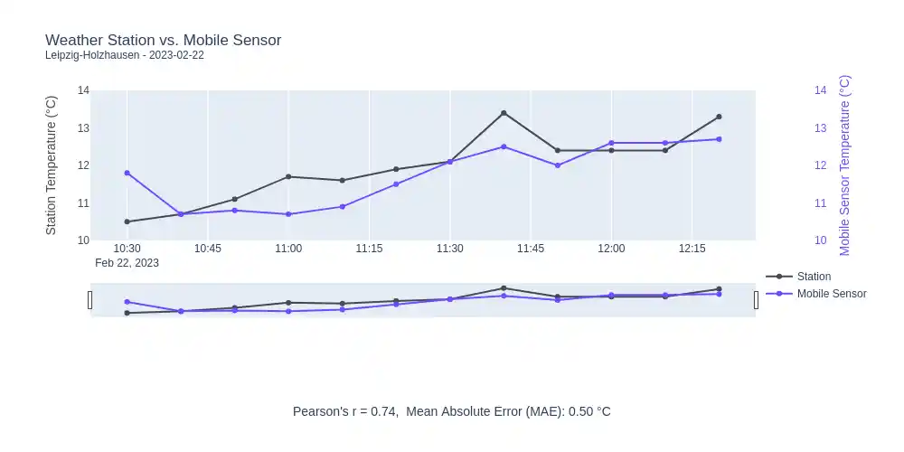
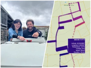
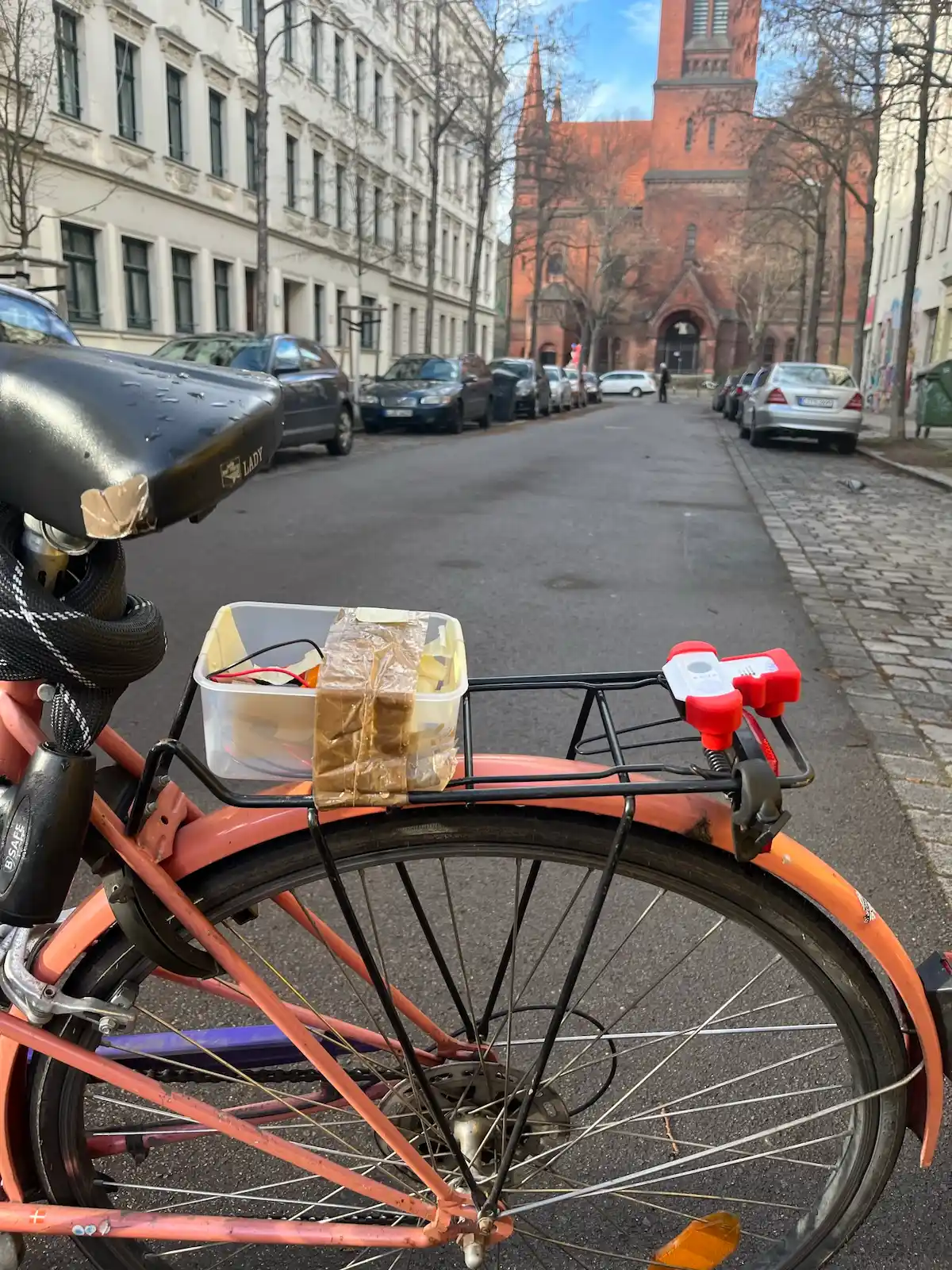
Our data scientist Helyne takes the MeteoTracker mobile weather stations for a ride around Leipzig to gather data.
We conducted a series of preliminary tests comparing the mobile sensor data with that of established, high-quality stationary weather stations. For instance, data collected in the city of Leipzig showcases the effectiveness of these sensors in capturing climate information. The sensor readings were found to be highly consistent with those from the stationary weather stations (Figure 2), with only minor deviations in certain cases.
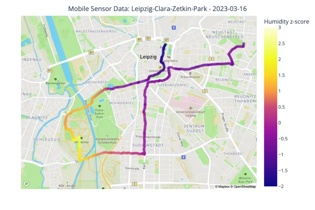
Furthermore, our study involved analyzing the spatial distribution of the sensor data to identify microclimate pockets in urban areas. We found statistically significant relationships between microclimate variations and local topographic features, such as changes in elevation and vegetation cover. As expected, parks and forests tend to be cooler and more humid than developed areas (Figure 3), highlighting the sensors' ability to capture these localized variations in climate conditions.
The mobile sensor data collected by our partners will be used in conjunction with our downscaling algorithms to produce more accurate microclimate forecasts for vineyards. By collecting on-site climate measurements, we can downscale traditional weather forecasts to provide more precise microclimate predictions. This is especially important for vineyards, where large microclimate variations can have a significant impact on grape quality and health. The insights and feedback gathered from the participants of our field trial will be invaluable in refining our mobile sensor system and its practical applications within the wine industry.
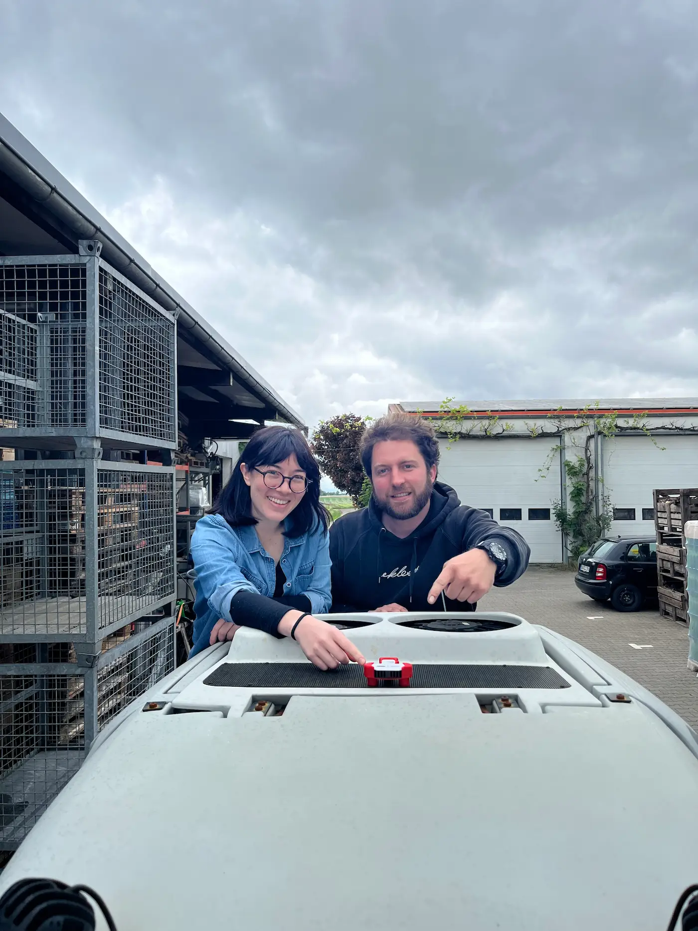
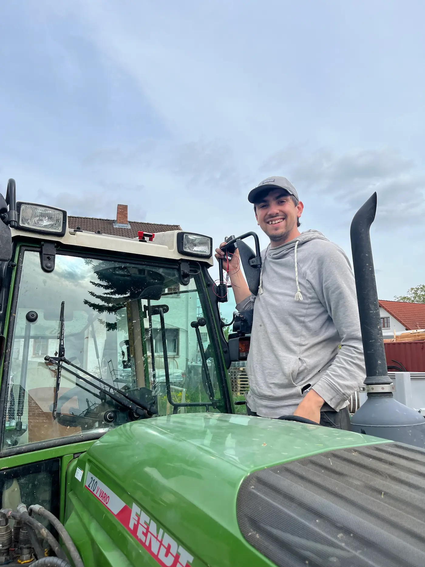
The installation of the mobile sensors at our project partners in early May.
Projects together with the Onsabrück University of Applied Sciences
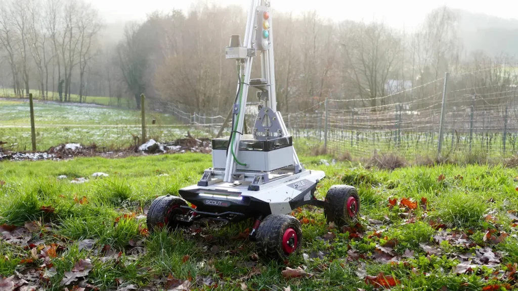
In addition to our own field trials, we have been supervising the student project "Robot of Vines" at the Osnabrück University of Applied Sciences since 2022 (https://www.hs-osnabrueck.de/loesungen-fuer-morgen/robot-of-vines/). In this project, the students have developed a self-propelled weather station. To do this, they mounted a sensor system on a rover that navigated itself collision-free through the vineyard of the Winery Brinkmann in a field test using GPS and RTK as well as a lidar sensor. Seven sensors measure air pressure, air temperature and humidity at a height of up to 2 meters.
Looking a little further into the future, the sensors may no longer need to be attached to an implement but will move through the vineyards automatically and record data wherever the algorithm still lacks some training data.